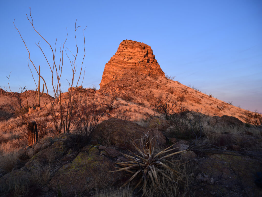
A few things grab your attention when you hike the Alamo Passage of the Arizona Trail. The first is Picketpost Mountain – how it rises out of the Sonoran scrub and commands the view for about four miles as you move north to south.
Telegraph Fire
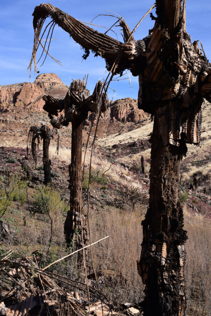
The next thing that will grab your attention is damage from the Telegraph Fire. The fire started somewhere in here and destroyed a lot of desert before racing toward Miami, where it torched several homes.
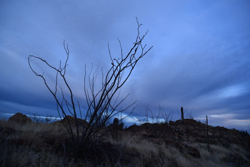
You may also notice, if you backpack this passage, that it’s awful dry out there. The Arizona Trail Association calls this one of the driest passages on the entire trail, so dry that it built a rain cache where passage 17 and 16 meet. I did find a little water when I made the hike on a cool January day, but I wouldn’t count on it.
Boyce Thompson
More of a butte than a mountain, Picketpost served as a signal station for U.S. troops in the late 19th century. William Boyce Thompson supposedly said it was “the most beautiful mountain he had ever seen.” He may have been serious, because he built a home near the foot of the volcanic rock pile and established an arboretum for desert plants from around the world, which remains to this day.
The passage, also known as passage 17, starts about a mile north of Highway 60, near Superior, then passes west of Picketpost along Alamo Canyon and continues south, through the Telegraph Fire burn scar.
The burn scar
Once you pass Picketpost, the trail passes over a few hills as you zigzag in and out of drainages, and every time you think the mountain is out of view you’ll come to a rise, look north, and there it is, the Superstitions in the blue distance. Occasionally the cliffs of Apache Leap come into view if you look east.
After about seven and half miles you’ll come to Forest Road 4. From here the hike rounds a bend and follows a drainage for a couple of miles, where the Telegraph Fire appears to have reached some of its early glory. Charred trees fill the bottoms and saguaros slump on the hillsides, broiled and skinned alive. The trail climbs out of the drainage and rises to its highest points. You’ll walk along a ridgeline, round a rocky outcrop and for the next mile or two you’ll drop, cross a drainage and climb again, until at last you come to a fence marking the end of the passage.
You’ll find a few campsites along this stretch, but not much firewood.
The next fire
The Alamo Passage is not the physical beat-down that some passages are known for, but if you carry all your water, which is highly recommended, it will be challenging enough. And although the fire damage looks alarming, a carpet of grass has papered over some of the damage, so it looks nice. The bad news is that much of this grass is invasive, which means the fuel for the next fire could already be there.
The Nitty gritty:
Access: The Alamo Canyon Passages is about 60 miles east of Phoenix on U.S. 60. Look for the turnoff for Picketpost Mountain Trailhead.
Maps: USGS: Teapot Mountain, Mineral Mountain and Picketpost Mountain. Tonto National Forest.
Best time to go: Fall, winter, spring.
Disclaimer: Please read. Have fun.