Decades ago, I backpacked into a place Soap Creek, tributary of the Colorado River in northern Arizona. It’s possible that just about everything about our trip was illegal – our dogs, our campfire on the beach, our feasting like Viking lords on a fat rainbow trout, howling at the moon. We did not have a permit.
The local fishing guides who put us onto the place were short on details. They said something about shimmying down a rope ladder, but nothing about permits. So we went, took advantage of the campfire ring that was already there and nature’s bounty. It is possible that all of this rogue woodcraft was legal back then. I have no idea.
Times have changed. I’ve been back a couple of times, without the dogs, the campfire, and I’ve always had a permit. The park boundary is well posted, the rope ladder is gone, but the canyon is pretty much the same. Canyoneers come in from the north end with ropes and harnesses. Hikers will want to take the south fork.
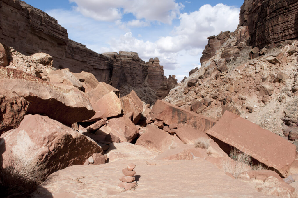
The Soap Creek hike starts out as a delightful little romp down a sandy canyon that pinches in to a series of rock shelves, easily downclimbed. It’s all fun and games until you come to the boulder pile. It’s as if a bomb struck, or the gods were angry, and it’s no fun with a backpack.
The rocks range in size from bowling balls to bungalows. Most are solid, but a few are wobblers. There are cracks and crevices, sharp edges. In places, cairns lead in two different directions at once. I remember a rope assist to get you past this one giant boulder.
The rockslide ends at a 15-foot pour-off, where the rope ladder was once located. It’s possible to skip this, backtracking and using a workaround to the right.
After this obstacle, it’s another few miles to the river. The whole hike is only about six miles, but on a warm day with a backpack it can feel like eight. Most of the hike is on Bureau of Land Management Land, but around the last mile, you’ll cross a Park Service boundary, which means you’ll need a permit to camp on the Colorado River. There’s a nice sandy beach there, and pretty good fishing.
The nitty-gritty:
Access: Access is off U.S. 89A, through a gate just past Cliff Dwellers Lodge and Mile Marker 548, that also leads to a local airstrip. Insider tip: Don’t drive on the airstrip.
Details: Don’t be like we were, decades ago, willing but ignorant. Get a permit. No campfires. Leave the dogs at home. https://www.nps.gov/grca/planyourvisit/campsite-information.htm
Best time to go: Spring, fall, winter.
USGS maps: Emmett Wash, Bitter Springs.
Disclaimer: Please read. Have fun.