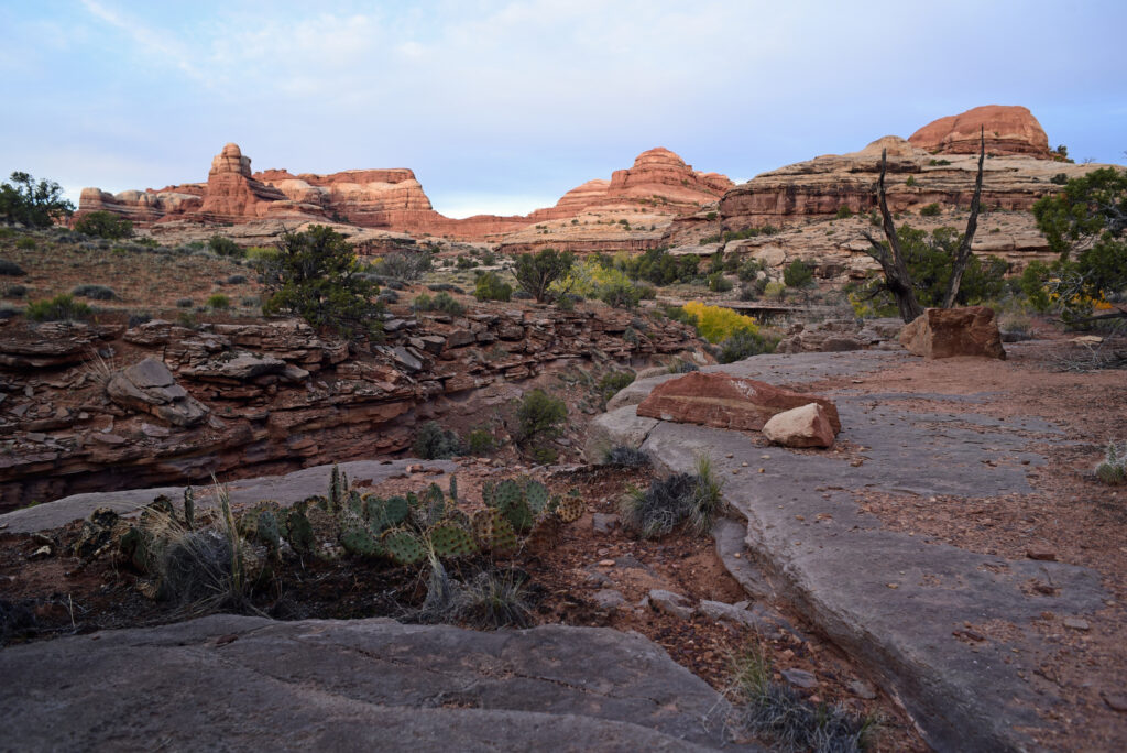
Getting lost in The Maze
I don’t know what I can tell you, other than don’t go, or think about it, or, take a friend and make sure you stop frequently for a map check. Getting turned around in The Maze is easy to do, and it’s not much fun. Trails are few and hard to follow. Water is scarce. The Maze District is a remote section of Canyonlands National Park where every canyon leads to some other canyon, and some other canyon after that. When George Washington Hayduke, the protagonist in The Monkey Wrench Gang, needed a place to hide, he chose The Maze. When journalists compile lists of dangerous places to hike, The Maze makes the cut. Only about 2,500 backpackers walk it in a given year. The Park Service doesn’t put up many signs out there. The roads are so bad it can take all day just to get to some of the trailheads.
It took us four days, but that’s because we had paddled 52 miles on the Green River to get there, floating under red cliffs and spires by day, sleeping on sandy beaches and listening to the river’s song at night. By the time we paddled past the confluence of the Green and Colorado Rivers and made camp at Spanish Bottom, we were still dazzled by redrock but willing to take on something different. The next day we ditched the canoes and set out.
The uphill climb
We walked up a series of switchbacks, gaining more than 1,000 feet of elevation in about a mile that took us from river to rim, where hoodoos stood sentry over a high desert expanse. We dropped packs to explore a Pueblo ruin, then started down a four-wheel drive road that doubled as a trail from the Dollhouse to Chimney Rock. Dark clouds stacked against the horizon, yet the trail was bathed in sunlight as we walked. It was getting late when we started following cairns that corkscrewed downhill through a labyrinth of gray slickrock. By the time we got to the bottom, it was time to make camp. There was water in potholes, a spring in the wash. A light rain started to fall later that night as we crawled into out tents.
In the morning we hiked down a shady, narrow canyon until it widened at a sunlit junction. By noon we stood at the Harvest Scene, a rock art panel with tall, wraith-like figures painted by Archaic hunter-gatherers. A couple of backpackers, the only ones we saw this trip, were just leaving. We dropped packs and lingered, taking pictures and basking in sunlight.
Not our first rodeo
About a decade ago, Tom and I took a similar trip, paddling for days down the Green, stashing the canoe, setting out on a bright and sunny day. We may have taken a wrong turn or two – it’s called The Maze for a reason, and we never made it to the Harvest Scene. It felt good finally get it right. The names in the map fell into place: Ernies Country, Horse Canyon, Chimney Rock, a few features that make the place sound like a Walt Disney theme park: The Doll House, Chocolate Drops, Happy Canyon.
After lunch we started hiking again, dropping packs to gather water at a spring, then turning up a fork to begin our exit. After a half-mile or so we turned again, following a set of footprints up a side canyon, our one wrong turn of the trip, but we did that map check, figured it out quickly and backtracked. By sunset we had climbed out of the canyon and were making camp.
The sun warmed a little section of slickrock that curved to the shape of our backs, and we leaned up against it, spreading our gear, looking out at the Chocolate Drops and a long slickrock point that extended to the edge of nowhere. The next day we’d be back at the canoes, but for now we settled in for a night of stargazing, perfect silence, the gifts of wilderness that we had come to enjoy.
Adapted from my story in Backpacker. Fun fact: The print version of this story carried someone else’s byline.
The nitty gritty
Whether you paddle or drive to the trailhead, hiking The Maze can easily take a week. An outfitter in Moab shuttles paddlers and backpackers. The Park Service requires permits for all overnight stays. It also requires a river permit for canoe and packraft adventures: Avoid summer. Tip: Before tackling The Maze, hike the Needles District of the park a few times to get experience navigating in slickrock.
Access: Access to The Maze is located off Highway 24 in Utah. Turn east on Hans Flat Road. From there, it’s 46 miles to the ranger station. The Maze does not have any services – no gas, no food, no potable water. You can access The Maze by a series of four-wheel drive roads, where a portable toilet is required. It can take hours to get to a trailhead. Permits are required for backcountry overnights. No pets. No fires.
Details: nps.gov/cany/planyourvisit/maze.htm; texsriverways.com.
Best time to go: Spring, fall.
Maps: USGS: Spanish Bottom, Elaterite Basin, Cleopatras Chair, Teapot Rock, Turks Head. National Geographic: Canyonlands National Park, Maze District. A waterproof map of the river, available through Tex and local vendors, is highly recommended.
Disclaimer: Please read. Have fun. Be careful.